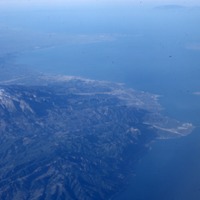
Aerial view West to Patras
Item
File name
sackett_009 See all items with this value
Title
Aerial view West to Patras See all items with this value
Description
This is an aerial view of the Gulf of Patras. The image captures the bay and the surrounding mountainous landscape including a larger, snow-capped mountain. See all items with this value
Place name
Pátron, Kólpos (bay) See all items with this value
Subject
Landscape
Ocean
Notes
The Gulf of Patras is a branch of the Ionian Sea in Western Greece and is closed by the Strait of Rion which connects it to the Gulf of Corinth. Several cities and towns would have been inhabited on both the eastern and western sides of the bay. There was only one major port, The Port of Patras, at the south-eastern end which was very significant in Roman times. A Roman colony was formed in the 2nd century BCE. On the southern side of the gulf of Patras is Mount Panachaiko of the North Peloponnese.
Date photographed
January, 1977
